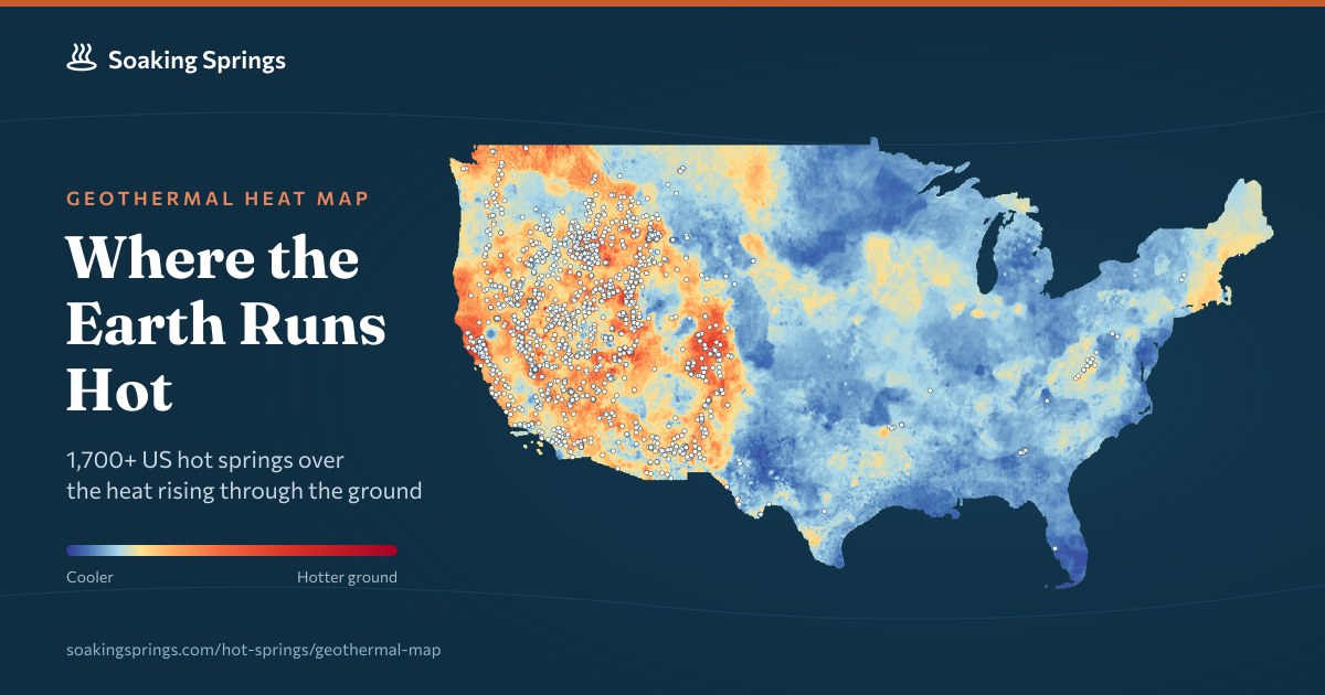
Geothermal heat map of US hot springs
A new online map visualizes the geothermal temperatures of hot springs across the United States, aggregating data from various sources. The tool allows users to explore regional heat patterns and compare spring temperatures. It aims to aid researchers, tourists, and developers interested in renewable energy and geothermal activity. The interface is interactive, using color-coded markers to indicate temperature ranges and providing location details for spring.